Skip to header Skip to main navigation Skip to main content Skip to footer
Home
Claim Jumper A-Frame 6
Your Cozy Summit in Red River

Enchanted Circle

Breadcrumb

  • Home
  • Enchanted Circle

The Aztec Mine: Following Willow Creek Gold Uphill to Baldy's Rich Lode
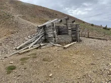
A collapsed mining-era log cabin on the rocky slopes of Baldy Mountain, above the Aztec Mine workings.

High on the eastern slope of Baldy Peak, at more than 10,000 feet in Colfax County, sat one of the richest small gold mines in New Mexico history. The Aztec Mine, on the Maxwell Land Grant, did not begin as a gold mine at all. It began with copper, and a chance conversation at Fort Union.
  • Read more about The Aztec Mine: Following Willow Creek Gold Uphill to Baldy's Rich Lode

Twining: The Ghost Town Beneath Taos Ski Valley

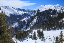
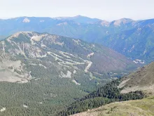
Taos Ski Valley's ski runs today, on the mountain above the site of the Twining mining camp.

Follow the Enchanted Circle Scenic Byway around its 84-mile loop of the high Sangre de Cristos and you will pass through some of the most storied ground in northern New Mexico. Few travelers realize that at one stop on that loop, the whole town is standing on a ghost town.

  • Read more about Twining: The Ghost Town Beneath Taos Ski Valley

The Motherlode: Dance Hall Nights on Red River's Main Street

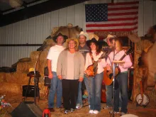
Western musicians pose on a hay-bale stage in Red River in 2008, heirs to the town's dance-hall music tradition.

Every mountain town has a room where the night comes together — and in Red River, for generations, that room has been the Motherlode. At 406 Main Street, the saloon with the big stage, the big dance floor, the pool tables in the back, and the front porch for watching the evening go by has been the town's honky-tonk through every era of its modern life.

  • Read more about The Motherlode: Dance Hall Nights on Red River's Main Street

The Big Five: Archaeology on Bitter Creek and Red River's Forgotten Placer Miners

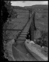
Water races down the wooden flume that carried Red River water toward the Elizabethtown gold workings, photographed about 1910 to 1920.

Ask most people about the Red River gold rush and they'll name Elizabethtown, the great Baldy Mountain camp that drew thousands in 1866. But the gold didn't stop at E-Town. In the narrow, heavily forested valleys around Red River itself — along Bitter Creek, Placer Creek, Gold Hill, and the little camps of Anchor and La Belle — a quieter generation of miners worked smaller placers for decades, and their story survived in government surveys and, remarkably, in the ground itself.

  • Read more about The Big Five: Archaeology on Bitter Creek and Red River's Forgotten Placer Miners

From Taos Peak to Wheeler Peak: How New Mexico's Highest Mountain Got Its Name

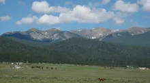
Wheeler Peak rises above the pastureland of the Moreno Valley, east of Red River.

It looms over the Enchanted Circle at 13,167 feet — the highest natural point in New Mexico, the rooftop of the state, visible from Red River, Eagle Nest, and Taos alike. For most of its known history it was called Taos Peak, after the town to its west. Then, in 1950, it was renamed for a man who never lived in New Mexico but mapped it: Major George Montague Wheeler.

  • Read more about From Taos Peak to Wheeler Peak: How New Mexico's Highest Mountain Got Its Name

The Colfax County War: Corruption, Murder, and Clay Allison on Red River's Doorstep

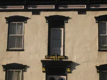
The St. James Hotel in Cimarron, built in 1880, a landmark of the Colfax County War years when Clay Allison frequented it.

In 1869, the brand-new Colfax County made the gold-rush boomtown of Elizabethtown its first county seat — a town that had been New Mexico's first incorporated municipality, founded three years earlier by Captain William H. Moore. The county seat would move to Cimarron in 1872, but the land war that followed it would rage for another decade and a half, and it would reach right to Red River's doorstep.

  • Read more about The Colfax County War: Corruption, Murder, and Clay Allison on Red River's Doorstep

San Antonio de Padua: Questa's 1842 Church and the Town That Wouldn't Let It Fall

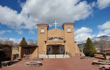
St. Anthony's Church, the San Antonio de Padua church in Questa, its adobe twin towers restored after the 2008 wall collapse.

Twenty-five miles north of Taos, in the center of the village of Questa, stands an adobe church that has been testing its community's devotion for nearly two centuries. San Antonio de Padua — Saint Anthony of Padua — anchors a parish whose roots reach back to the first years of the settlement the Spanish called San Antonio del Rio Colorado.

  • Read more about San Antonio de Padua: Questa's 1842 Church and the Town That Wouldn't Let It Fall

Ernie Blake's Gamble: The Man Who Spotted Taos Ski Valley from His Cessna

Snow-covered runs and a lift station at Taos Ski Valley, the ski area Ernie Blake founded in 1955.

In the early 1950s, Ernie Blake had an unusual commute. The Swiss-German skier was managing the Santa Fe Ski Basin and a sister resort in Glenwood Springs, Colorado, and rather than driving between them, he flew his own Cessna 170 — about six hours of driving saved each way. But the flights gave him something better than time: a bird's-eye view of the Sangre de Cristo Mountains, and a growing obsession with finding the perfect mountain for a ski area of his own.

  • Read more about Ernie Blake's Gamble: The Man Who Spotted Taos Ski Valley from His Cessna

Kit Carson's Taos Home: The Frontiersman Who Settled on the Enchanted Circle

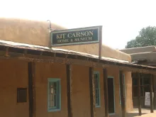
The Kit Carson Home and Museum in Taos, the adobe house Carson bought in 1843 and lived in until 1868.

Just east of the Taos Plaza, on a quiet stretch of Kit Carson Road, stands a modest single-story adobe house — and few buildings in New Mexico have sheltered a bigger life. Built in 1825 in the Spanish Colonial style, an east-facing U wrapped around a central courtyard, the house was purchased in 1843 by frontiersman Kit Carson as a wedding gift for his young bride, María Josefa Jaramillo.

  • Read more about Kit Carson's Taos Home: The Frontiersman Who Settled on the Enchanted Circle

Angel Fire's Chapel: How Two Grieving Parents Built America's First Vietnam Veterans Memorial

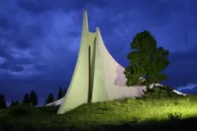
The Peace and Brotherhood Chapel at the Vietnam Veterans Memorial in Angel Fire, floodlit at dusk.

On May 22, 1968, Marine First Lieutenant David Westphall was killed in an ambush near Con Thien in Vietnam. He was twenty-eight years old. Back home on their ranch near Angel Fire, New Mexico, his parents, Dr. Victor "Doc" Westphall and his wife Jeanne, made a decision that would reshape how America remembers the Vietnam War: they would build a memorial to their son and his fallen comrades, using David's military life insurance to pay for it.

  • Read more about Angel Fire's Chapel: How Two Grieving Parents Built America's First Vietnam Veterans Memorial

Pagination

  • Previous page ‹‹
  • Page 2
  • Next page ››
Subscribe to Enchanted Circle

Click Here to Book Now

Upcoming Events

🎉 Weekly Events and Daily Calendar

Webcams

🎥 View Live Red River Webcams

Red River, NM Weather

Loading current conditions...

Loading forecast...

 Click Here for More Information

Footer menu

  • → Red River Tales

Copyright © 2026 - Red River New Mexico LLC - All rights reserved

Developed and Designed by Rocky Mountain Madman LLC