Skip to header Skip to main navigation Skip to main content Skip to footer
Home
Claim Jumper A-Frame 6
Your Cozy Summit in Red River

Enchanted Circle

Breadcrumb

  • Home
  • Enchanted Circle

The Little Red Schoolhouse: Where Red River Keeps Its Past
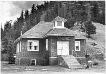
The Little Red School House in Red River, photographed about 1980.

Before Red River was a ski town, before it was a tourist town, it was a mining camp — and mining camps needed schools. Around 1917, a small one-room schoolhouse rose in Red River, and for the next two decades it rang with the lessons and laughter of the town's children.
  • Read more about The Little Red Schoolhouse: Where Red River Keeps Its Past

84 Miles Around the Mountain: The Enchanted Circle Scenic Byway

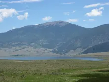
Eagle Nest Lake on the Enchanted Circle, with the mountains of the Moreno Valley rising behind it.

It begins and ends in Taos and circles the highest mountain in New Mexico: the 84-mile Enchanted Circle Scenic Byway is northern New Mexico's grand tour, and Red River sits right on it.

The route follows four highways — U.S. 64 between Eagle Nest and Taos, NM 522 from Taos to Questa, NM 38 through Questa, Red River, and Eagle Nest, and NM 434 between Eagle Nest and Angel Fire — looping around 13,161-foot Wheeler Peak through the Carson National Forest. It was designated a National Forest Scenic Byway in 1989 and joined New Mexico's state scenic byway program in 1998.

  • Read more about 84 Miles Around the Mountain: The Enchanted Circle Scenic Byway

New Mexico's Rooftop: The Making of the Wheeler Peak Wilderness

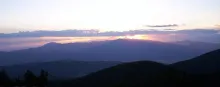
The sun sets behind Wheeler Peak, New Mexico's highest summit, in the Sangre de Cristo Range.

At 13,161 feet, Wheeler Peak is the highest point in New Mexico — and the rugged country around it is among the most protected ground in the state. The 19,661-acre Wheeler Peak Wilderness, tucked into the Carson National Forest just south of Red River, became the forest's first federally designated wilderness in 1964.

  • Read more about New Mexico's Rooftop: The Making of the Wheeler Peak Wilderness

Stokes Bolton and the Oil-Derrick Chairlift: How Red River Learned to Ski

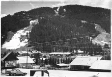
Red River's ski slopes above town in a black-and-white photograph from about 1980, the runs cut through the spruce forest above the rooftops.

When Oklahoma oil man Stokes Bolton rolled into Red River in the 1950s, the town counted barely a dozen year-round residents. He had never skied a run in his life. What he had was an entrepreneur's eye: the steep, snowy slopes rising above town looked like a business waiting to happen. In 1959 he opened the Red River Ski and Summer Area with a rope tow, a poma platter lift, and a chairlift cobbled together from salvaged oil derricks — and a ski town was born.

  • Read more about Stokes Bolton and the Oil-Derrick Chairlift: How Red River Learned to Ski

Elizabethtown: The Gold Rush Ghost Town on the Enchanted Circle

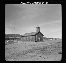
The wooden church at Elizabethtown, New Mexico, photographed by John Collier for the Office of War Information in 1943.

In the fall of 1866, a Ute Indian walked into Fort Union carrying a handful of “pretty rocks” — copper ore — and asked to trade them for winter supplies. The man behind the sutler’s store counter, retired Captain William H. Moore, recognized copper when he saw it and struck a deal to be led to its source. What followed built a town — and then quietly unbuilt it.

  • Read more about Elizabethtown: The Gold Rush Ghost Town on the Enchanted Circle

Pagination

  • Previous page ‹‹
  • Page 3
Subscribe to Enchanted Circle

Click Here to Book Now

Upcoming Events

🎉 Weekly Events and Daily Calendar

Webcams

🎥 View Live Red River Webcams

Red River, NM Weather

Loading current conditions...

Loading forecast...

 Click Here for More Information

Footer menu

  • → Red River Tales

Copyright © 2026 - Red River New Mexico LLC - All rights reserved

Developed and Designed by Rocky Mountain Madman LLC